USGS maintains “WATCH” level, “ORANGE” color code on 4 US volcanoes; 2 more at “ADVISORY, “YELLOW”
The USGS continues to monitor volcanoes across the United States; today 4 of them have increased WATCH/ORANGE status due to their respective activity. The four volcanoes showing signs of restlessness or activity are Great Sitkin Volcano, Pavlof, Semisopochnoi, and Kilauea. The two volcanoes that received ADVISORY/YELLOW status are Mauna Loa and Davidof. All other volcanoes USGS is monitoring today are rated GREEN or not rated.
Within the United States, the USGS tracks 161 potentially active volcanoes, most of which are in Alaska. However, Alaska is home to many volcanoes; There are more than 130 volcanoes and volcanic fields that have been active in the geologically young last 2 million years. 50 have been active since the mid-17th century and AVO studies these as well.
Another place famous for its volcanoes is Hawaii; On the Big Island of Hawaii, Kilauea, Mauna Loa, and Hualalai are considered active and potential threats, but only one is erupting today: Kilauea. The US is home to only a fraction of the world’s volcanoes: according to the USGS, there are typically around 2 dozen erupting volcanoes around the world at any one time. According to the USGS, there are about 1,500 potentially active volcanoes worldwide, with about 500 erupting in modern historical times.
The Hawaii volcanoes are monitored by the Hawaii Volcano Observatory (HVO), while the Alaska volcanoes are monitored by the Alaska Volcano Observatory (AVO). In addition to AVO and HVO, there are also the California Volcano Observatory, the Cascades Volcano Observatory, and the Yellowstone Volcano Observatory and the Northern Mariana Volcano Observatory. Each of these additional volcano observatories within the USGS monitors volcanoes in their respective regions. Currently, none of these other observatories are reporting any unusual activity or any sign of anything more than background noise.
In the United States, the USGS and Volcano Observatory Units are responsible for issuing aviation codes and warning levels for volcanic activity. Aviation codes are green, yellow, orange, or red. If ground-based instrumentation is insufficient to determine that a volcano is at a typical background activity level, it is simply “unassigned”. While green signifies typical activity associated with a non-eruptive condition, yellow means a volcano is showing signs of heightened agitation above known background levels. If a volcano has increased or escalating unrest with increased eruption potential, it will bounce to orange. Finally, the code turns red when an eruption is imminent and a significant release of volcanic ash into the atmosphere is expected, or an eruption is in progress with a significant release of volcanic ash into the atmosphere. Volcanic activity alert levels are Normal, Advisory, Monitoring, or Warning. As with aviation codes, insufficient data is simply marked as “unassigned”. If the volcano has typical background activity in a non-erupting state, it is considered normal. If the volcano shows signs of heightened agitation above background levels, an alert will be issued. If a volcano exhibits heightened or escalating unrest, a vigil will be issued, while an alert will be issued if a dangerous eruption is imminent.

Great Sitkin Volcano is a basaltic andesite volcano occupying most of the northern half of Great Sitkin Island, a member of the Andreanof Islands group in the central Aleutian Islands. It is about 26 miles east of Adak, which is 1,192 miles southwest of Anchorage. According to AVO, the volcano has a composite structure consisting of an older dissected volcano and a younger parasitic cone with a 1.8-mile-diameter summit crater. A steep lava dome, intercalated during a 1974 eruption, occupies the center of the crater. Within the last 280 years, a large explosive eruption produced pyroclastic flows here that partially filled the Glacier Creek valley on the southwest flank.
Slow lava flow at Great Sitkin likely continues, according to AVO. “Seismic activity remains at low levels and satellite and webcam views have been largely obscured by clouds for the past 24 hours,” the USGS said in an update today. But USGS also adds caution: “It is possible that explosive activity could occur with little or no warning.”

Pavlof Volcano is a stratovolcano on the southwestern end of the Alaska Peninsula, just under 600 miles southwest of Anchorage. The volcano is about 4.4 miles in diameter and has active vents on the north and east sides near the summit. According to the USGS, the volcano has had more than 40 historical eruptions, making it one of the most consistently active volcanoes in the Aleutian Arc. The Aleutian Arc lies on the Pacific Ring of Fire.
AVO says eruptive activity at Pavlof continues; Seismic tremors have been present for the past day and a few small explosive events have been noted. “Small explosions related to the current eruption could occur at any time and be accompanied by small plumes of ash in close proximity to the volcano. The level of unrest at Pavlof can change rapidly and progression to more significant eruptive activity can occur with little or no warning,” warns AVO in today’s update.

Based on its location on the globe at 179° 46′ East, Semisopochnoi is the easternmost land location in the United States and North America, located just 9.7 miles west of the 180th meridian in Alaska. Semisopochnoi is part of the Aleutian Islands, a chain of 14 large volcanic islands and 55 smaller other islands. These islands, with their 57 volcanoes, form the northernmost part of the Pacific Ring of Fire. Semisopochnoi is monitored by local seismic and infrasonic sensors, satellite data, regional infrasonic and lightning detection instruments.
AVO said siesmic tremors and occasional small explosions were detected in seismic and infrasound data over the past day. USGS says small eruptions are producing smaller ash deposits near Mount Cerberus’ active north crater on the volcano, and that ash plumes recently usually remain below 10,000 feet above sea level. However, USGS adds caution: “Small explosions and associated ash emissions can be persistent and difficult to detect, especially when thick cloud cover obscures the volcano.”
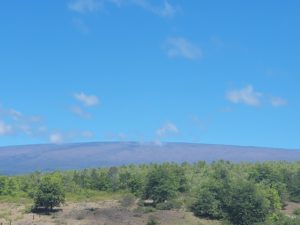
Although today it only has ADVISORY /YELLOW status, USGS continues to closely monitor Hawaii’s Mauna Loa volcano. While USGS is quick to point out that Mauna Loa is not erupting today and is not expected in the immediate future, it remains the world’s largest active volcano and will inevitably erupt at some point in the future.
Considered the largest active volcano on earth, Mauna Loa rises to 13,681 feet above sea level. Mauna Loa rises from the Central Pacific ocean floor at a depth of about 3 miles. Due to the volcano’s considerable mass, the sea floor directly below Mauna Loa is lowered an additional 5 miles. According to the USGS, this places Mauna Loa’s summit about 56,000 feet above its base; The giant volcano covers half of the island of Hawaii, also known simply as the “Big Island of Hawaii.”
Mauna Loa eruptions tend to produce voluminous, fast-moving lava flows that can strike communities on the east and west sides of the Big Island from Kona to Hilo. Since the 1850s, Hilo in eastern Hawaii has been threatened by seven Mauna Loa lava flows. On the south and west sides of the island, Mauna Loa lava flows have hit the shore eight times: in 1859, 1868, 1887, 1926, 1919, and three times in 1950.

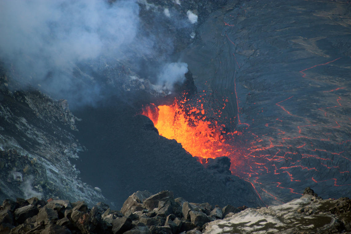
While Mauna Loa is on ADVISORY/YELLOW, Kilauea is on WATCH/ORANGE. While activity has pulsed in and out for the past few weeks, Kilauea continues to erupt. All recent lava activity has been confined to the crater and there is no evidence of activity migrating to other locations on Kīlauea. While lava is not currently a threat to the island, volcanic gas is a worrying hazard. In an update released today by HVO, they write: “This eruption at the summit of Kīlauea is occurring in a closed area of Hawaiʻi Volcanoes National Park. Therefore, high concentrations of volcanic gas are the main hazard as this hazard can have far-reaching effects downwind. Large amounts of volcanic gas – mainly water vapor (H2O), carbon dioxide (CO2) and sulfur dioxide (SO2) – are continuously released during eruptions of the Kīlauea volcano. As such2 released from the summit, it reacts in the atmosphere and produces the visible haze known as vog (volcanic smog) that has been observed downwind of Kīlauea.” Vog may pose potential airborne health hazards to residents and visitors, and could also affect agricultural crops and damage other crops and livestock.
HVO/USGS urges visitors to Hawaii Volcano National Park and its Kilauea volcano to exercise extreme caution at all times. “Other significant hazards also remain in the vicinity of the Kīlauea Caldera from the instability of the Halemaʻumaʻu crater wall, ground cracks and rockfalls that may be exacerbated by earthquakes within the area closed to the public. This underscores the extremely hazardous nature of the rim around Halemaʻumaʻu Crater, an area that has been closed to the public since early 2008.”
Comments are closed.